
A Walkers Brief
To enable us to ensure that our proposed trail is walkable across all of its sections, we are inviting community participants to walk sections of it on our behalf and report back their findings.
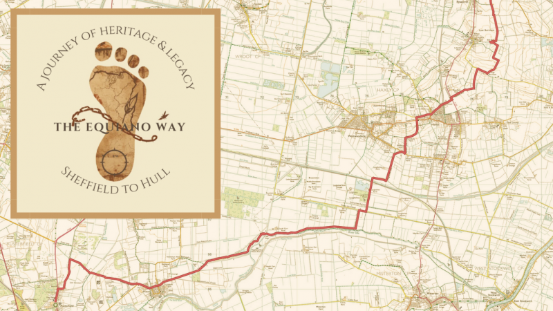
It is essential that the walkers undertaking the sections that have been mapped follow the routes exactly as shown on the OS map app, unless the way becomes impassable, at which point the ‘diversion’ should be fully mapped and described by them. Any detour must be on a verified footpath, bridleway or other designated footpath or along a road (preferably with a pavement).
When walking the route participants must:
- Follow the route as mapped on the OS app (and therefore download and use the OS app) – https://shop.ordnancesurvey.co.uk/maps/os-maps-subscriptions/
- Note and describe the route in detail as you walk including:
- Turnings in the path and whether they are signed using markers or finger posts etc.
- Gateways (style of gate – (kissing gate / swing gate etc.).
- Any stiles on the route.
- Any livestock encountered (sheep / cows).
- Key points of interest on the route (e.g. churches, historic buildings, features in the landscape).
- How busy sections of the road are if using, including whether there is a pavement to use.
- If the route has to cross a railway and what the type of crossing is.
- If there are toilet or refreshment facilities on route.
- If there are places to stay overnight at the start and end of each section.
- Take as many photographs as possible.
Once completed the route description and all photographs must be submitted to manager@epwortholdrectory.org.uk who may also contact you to add further detail to sections of the route if this is unclear.
Downloads
- A Walkers Brief108 KB